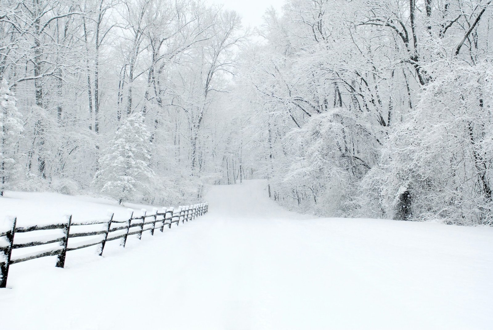
The Upcoming Winter Storm
The northeastern United States is bracing for a significant winter storm warning, as forecasts indicate an imminent ice and snow event that is set to impact New England. This storm is particularly noteworthy due to its timing, coinciding with the winter vacation week and Presidents Day weekend, a period when travel plans are at their peak. As families and individuals prepare for their journeys, the potential disruptive effects of this weather system cannot be overstated.
Current meteorological data suggests that this winter storm will bring with it hazardous conditions, including heavy snow and freezing rain. Such weather patterns can create treacherous roadways, making travel increasingly dangerous. The added burden of icy conditions could also lead to power outages, potentially impacting thousands of homes across the region. Moreover, as this storm approaches, local authorities are likely to issue advisories and updates to inform the public about safety measures and necessary precautions.
The impact of this storm could disrupt not only daily commutes but also planned festivities during a time when many families seek to relax and enjoy gatherings. With many residents looking forward to outdoor activities or travel arrangements to ski resorts and other recreation areas, the winter storm warning serves as a reminder of nature’s unpredictable power. As the event draws nearer, it is crucial for individuals to remain informed about the developments and be prepared for the consequences of severe winter weather, particularly during a historically busy travel period in New England.
Current Weather Conditions
The current weather in New England presents a stark contrast to the impending winter storm warning that has been issued for the region. As of now, the atmosphere is characterized by cloudy skies and unseasonably dry conditions. This lack of moisture in the atmosphere is deceptive, as it sets the stage for what is expected to be significant snowfall later in the evening.
The temperatures, hovering in the frigid range of the 20s Fahrenheit, are indicative of a typical New England winter. These low readings contribute to a chilling environment, enhancing the sense of urgency as residents prepare for the coming storm. The dry air, combined with the cold temperatures, suggests that when precipitation does commence, it will likely fall as snow rather than rain. This is crucial, as a winter storm warning indicates that significant snow accumulations are expected, which could lead to hazardous travel conditions and disruptions within the community.
Timeline of Snowfall
The impending winter storm warning for New England, particularly in Boston, indicates a significant weather event that will unfold in several stages. The snowfall is expected to commence around 6 p.m. when light snow begins to blanket the area. As temperatures will likely be at or just below freezing, this initial phase may lead to slippery conditions on the roads, particularly for those who are commuting home from work.
As the evening progresses, the snow intensity is anticipated to increase, transitioning into steady snowfall overnight. Meteorologists predict snowfall rates between 0.5 to 1 inch per hour, resulting in accumulating snow that could impact travel and daily activities. This steady accumulation will likely lead to reduced visibility, as well as the potential for hazardous driving conditions. Residents are advised to remain cautious during this period, as the combination of falling snow and preexisting weather conditions could result in dangerous roadways.
By midnight, the storm will reach its peak, contributing to further accumulations and potentially creating conditions reminiscent of past winter storm occurrences in the region. The onset of this icy blast calls for preparedness from local communities and emergency services alike, ensuring that resources are allocated to maintain safety and clear pathways. As morning approaches, the snowfall may begin to taper off, transitioning to lighter flurries by dawn. However, the total accumulation by this time could vary greatly depending on the storm’s trajectory and intensity.
For residents of Boston and its surrounding areas, understanding this timeline is crucial for making informed decisions. Whether considering travel plans or preparing their homes, staying informed about the evolving weather conditions will be essential to navigate the potential challenges posed by the winter storm warning.
Transition to Ice: What to Expect
As winter approaches New England, the region is often confronted with severe weather patterns that are distinct and challenging. One such weather phenomenon is the transition from snow to sleet and freezing rain, which can significantly impact daily life. Understanding the meteorological factors contributing to this shift is essential for residents, especially during a winter storm warning. It is important to note that warm air aloft, typically moving in from the south, plays a crucial role in this transition.
Initially, as a winter storm approaches, cold air is prevalent at the surface, resulting in snowfall. However, as warm air begins to ascend above the cold layer, it creates a classic scenario for the formation of mixed precipitation. This warm air, which often originates in the Gulf of Mexico, rides up and over the cold air at the surface. As it travels, temperatures in the upper atmosphere begin to rise, leading to a melting phase of the snowflakes. Consequently, these partially melted snowflakes may become sleet as they encounter colder air during their descent or transform into freezing rain upon reaching the ground, creating icy conditions.
This shift not only changes the type of precipitation but also heightens the hazards associated with winter storms. Roads become treacherous, with the potential for ice accumulation resulting in hazardous driving conditions. Falls can become a significant concern as ice forms on sidewalks and steps, increasing the risk of injury. Residents are advised to monitor the latest updates from local meteorological services for accurate forecasts during winter storm warnings. By understanding these conditions, communities can better prepare for and respond to the challenges posed by transitional winter weather.
Freezing Rain Accumulations
As winter approaches, weather predictions indicate a significant winter storm warning for regions throughout New England, specifically highlighting the potential for freezing rain accumulations. Meteorological forecasts suggest that ice accumulation could reach between 0.2 to 0.3 inches in certain areas. This level of ice buildup poses a serious risk to both infrastructure and transportation.
Particularly noteworthy is the consideration of areas located outside of Interstate 495, where temperatures are expected to remain colder. In these regions, conditions conducive to freezing rain may persist longer than in more temperate locations. The sustained freezing temperatures will prevent the melting of accumulated ice, exacerbating hazardous travel conditions. Residents in these locales should exercise caution, as untreated roads and surfaces can become extremely slippery, increasing the likelihood of accidents and challenging travel.
The impact of freezing rain extends beyond mere inconvenience; it can lead to widespread disruptions. Accumulations can complicate day-to-day activities by affecting power lines and trees, leading to potential outages and downed branches. Emergency services may become overextended as they respond to numerous incidents resulting from hazardous travel. Furthermore, the icy conditions may prompt local authorities to implement travel restrictions, urging residents to stay home until conditions improve.
In light of these anticipated conditions, it is prudent for those throughout New England to remain informed via local weather alerts and advisories. It is essential to prepare for the potential impacts of freezing rain and emerge safely from the winter storm warning. By taking proactive measures, such as stocking up on essentials and planning for potential travel delays, individuals can mitigate the adverse effects of the freezing rain event, ensuring their safety during the winter months.
Boston’s Weather Changes Through the Weekend
This weekend, Boston is poised to experience a significant transformation in its weather patterns as a winter storm warning is in effect. The forecast indicates an initial phase characterized by freezing rain, which may lead to icy conditions across the city. Starting Friday evening, residents should prepare for the potential hazards associated with icy surfaces, including slip hazards on roads and walkways.
As we progress into Saturday morning, the accumulation of ice is expected to diminish, giving way to a transition towards warmer conditions. The precipitation is anticipated to shift from ice to rain, creating a challenging environment for travel and outdoor activities. The winter storm warning will highlight the importance of monitoring local updates, as the weather can change rapidly within a short timeframe.
If all goes as forecasted, Saturday afternoon is expected to bring substantial rainfall. This surge in precipitation will likely accumulate between two to three inches, depending on location and ongoing weather conditions. The heavy rain is projected to start around midday and will continue into the evening hours. Residents should remain vigilant about potential flooding, as the ground may still be cold and can become oversaturated quickly due to the sheer volume of rain.
Experts urge taking precautionary measures, such as avoiding driving during the heaviest periods of rain or checking for any possible power outages caused by the adverse weather conditions. With the forecast indicating shifting and dynamic weather patterns, it is crucial for residents of Boston to stay informed about the evolving situation. Weather updates will provide essential insights into the timing and severity of the winter storm warning that currently affects the area.
Effects on Travel and Commute
As a winter storm warning is issued for New England, travelers should brace themselves for significant disruptions during the long weekend. The forecast indicates heavy snowfall combined with ice accumulation, which may severely affect road conditions, public transportation schedules, and overall travel plans. Travelers are urged to monitor local weather updates and be prepared for possible changes to their itineraries.
In anticipation of hazardous conditions, individuals planning to travel should reconsider their routes and possibly delay non-essential trips. Major road networks are expected to experience delays and closures due to snow plowing efforts and ice mitigation strategies. Freezing rain can create particularly treacherous driving conditions, making it imperative for motorists to remain vigilant and make smart decisions on the road. It is crucial to check for real-time traffic updates and heed any local advisories regarding transportation safety.
For commuters who rely on public transit, be advised that services may be delayed or rerouted as winter storms impact trains and bus schedules. Utilizing mobile apps or websites for real-time updates can help keep commuters informed about any changes. Preparation is key; allow extra time for travel and consider alternative routes or modes of transportation. If travel is unavoidable, ensure your vehicle is winter-ready and stocked with essential supplies, including blankets, food, and a flashlight, in case you become stranded.
Ultimately, staying informed and taking necessary precautions is vital to navigating the impact of winter storms on travel plans effectively. By doing so, individuals can promote their safety and minimize the disruptions caused by adverse weather. Prioritizing preparation ensures that commuters will reach their destinations efficiently while enhancing personal safety during this challenging weather event.
Local Advisories and Warnings
As a winter storm approaches New England, local advisories and warnings have been issued to ensure the safety and well-being of residents. The National Weather Service (NWS) is monitoring the situation closely and has released a series of alerts that provide essential information regarding the severity and anticipated impact of the storm. Areas of New England can expect hazardous conditions, prompting the issuance of a winter storm warning in several regions, which signifies that significant accumulations of snow, sleet, or ice are expected within a specific timeframe.
Residents are strongly encouraged to stay informed by frequently checking updates from local authorities and the NWS. Social media platforms, local news stations, and meteorological websites serve as vital resources for receiving the latest information. It is crucial to adhere to travel advisories issued by state and local officials, as winter storms can lead to dangerous road conditions, including ice accumulation and reduced visibility. These advisories often highlight areas where travel should be limited or avoided altogether to protect public safety.
Moreover, preparedness plays a pivotal role in minimizing the impact of severe winter weather. It is advisable to stock up on essentials such as food, water, medications, and heating supplies. Families should also have an emergency kit ready, including flashlights, batteries, and first-aid supplies. In addition to personal preparedness, residents should check on their neighbors, especially the elderly or those with mobility issues, to ensure they are equipped to handle the impending storm.
By remaining vigilant and responsive to local advisories, individuals can significantly enhance their safety during winter storms. This proactive approach not only helps in mitigating risks associated with the storm’s impact but also fosters a sense of community preparedness across the region.
What to Do Before the Storm Hits
As a winter storm warning approaches, residents of New England must take proactive measures to ensure safety and comfort during the impending weather. Preparation should begin well in advance, focusing on essential supplies, home readiness, and vehicle maintenance.
First and foremost, stocking up on necessary supplies is crucial. As the storm looms, residents should create an inventory of items needed to endure potential power outages or difficult travel conditions. Essential items include non-perishable food, bottled water, medicines, batteries, and home heating fuel. It is advisable to purchase enough provisions to last at least a few days, as heavy snowfall can impede access to stores. Additionally, having a first-aid kit on hand can be invaluable in case of emergencies.
Next, winterizing the home is a key step in preparing for icy weather conditions. To prevent heat loss, residents should ensure that windows and doors are properly sealed, and consider adding insulation if needed. Checking the heating system and cleaning the gutters will help avoid ice dams that can lead to structural damage. Furthermore, removing debris from walkways and driveways is essential to ensure safe access during and after the storm.
Lastly, it is crucial to prepare vehicles for the challenging conditions that accompany winter storms. This includes checking tire tread and pressure, topping off antifreeze, and ensuring that wiper blades are in good condition. It is also recommended to keep an emergency kit in the car, which should include blankets, a flashlight, and other supplies that may be needed if travel becomes hazardous.
By taking these steps before a winter storm warning is issued, New England residents can increase their safety and comfort, reducing the impact of the severe weather on their lives.